Search by topic
- archaeology
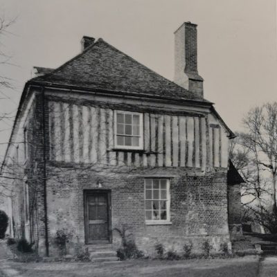
- Building of Local Interest
- charity
- church
- crime
- dressmaker
- fire
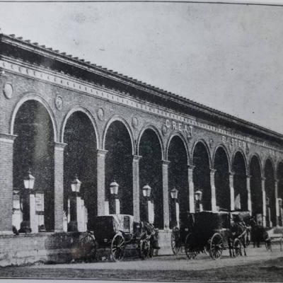
- Great Eastern Railway
- Listed building
- Mapping Relief
- medieval
- oral history
- poverty
- Public House
- Rattee & Kett
- Religious House
- Roman
- scholar
- school
- Then and Now
- tudor
- women
- work
- world war one
- world war two
Search by text
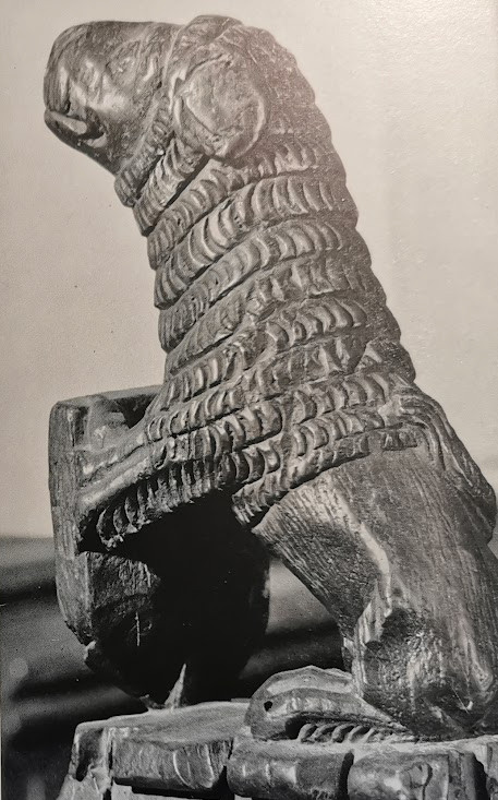 Comberton church, bench finial, late medieval (RCHM)
Cambridgeshire 1066 – 1500
Overview of Cambridgeshire 1066 - 1500
This is an edited AI generated summary of the evidence available on Capturing Cambridge for events and developments in Cambridgeshire during the period 1066 -1500. As such it will be periodically updated and checked as new material is uploaded. Comments are welcome.
Cambridgeshire 1066–1500: A Detailed Historical Study Through Capturing Cambridge
The period between the Norman Conquest in 1066 and the end of the 15th century was one of profound transformation in Cambridgeshire. Over these four centuries, the county evolved from a largely rural Anglo-Saxon landscape into a region defined by castles, monasteries, expanding market towns, parish structures, and—by the later Middle Ages—one of Europe’s most significant centres of scholarship. Although many physical structures from this period have been altered, rebuilt, or lost, traces survive through archaeology, street patterns, medieval churches, monastic foundations, and domestic buildings. Capturing Cambridge preserves this legacy through heritage records, conservation reports, archaeological commentary, and landscape history.
This study examines the long medieval era in Cambridgeshire using Capturing Cambridge as a key interpretive resource, offering insight into settlement, religion, education, economy, governance, art, architecture, and community life. It also highlights the continuity between medieval Cambridgeshire and the later development of the region.
I. Historical Context: Why 1066–1500 Matters in Cambridgeshire History
Five defining forces shaped the era:
1. Norman military and administrative transformation
Feudalism, castle-building, land surveys, and new legal systems altered political and territorial organisation.
2. Economic and demographic expansion
Between c.1100 and 1300, population grew, villages expanded, and market trading intensified.
3. The Church as economic, social, and cultural power
Monasteries, friaries, and parish churches shaped landscape, memory, charity, learning, and daily life.
4. Environmental and agricultural rhythm
Open-field farming, sheep-grazing, fenland water management, and manorial systems structured rural existence.
5. Political unrest and recovery
The Anarchy, baronial conflicts, plague, and the Wars of the Roses affected governance and property.
Capturing Cambridge helps trace how these large-scale forces became embedded in physical spaces still visible today.
II. Case Studies From Capturing Cambridge (Medieval Evidence)
A. Castles, Defence, and Norman Authority
1. Cambridge Castle (late 1060s)
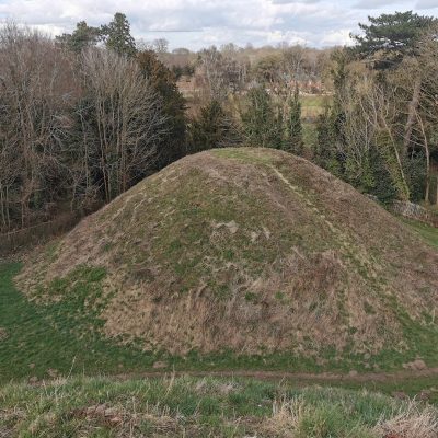
Built soon after the Norman Conquest, Cambridge Castle served as a military fortification, administrative seat, and deterrent against rebellion. Although little survives today, Castle Mound—referenced in Capturing Cambridge entries—remains a visible reminder of Norman power.
The castle influenced settlement patterns, road networks, and later civic building, marking Cambridge as a regional centre of royal authority.
2. Motte-and-bailey landscapes beyond the city
Surrounding villages, including reach points near the Ouse and fen-edge, contain archaeological traces of Norman lordship—some referenced in Capturing Cambridge’s village entries.
B. Churches, Monastic Institutions, and Religious Culture
3. Barnwell Priory (founded 1092)
One of Cambridgeshire’s most influential religious centres, Barnwell Priory dominated medieval life east of Cambridge. Capturing Cambridge entries on Newmarket Road preserve references to its lands, water systems, and later demolition.
Its economic reach included mills, fisheries, farmland, tenants, and tolls—demonstrating how monasteries structured medieval economies.
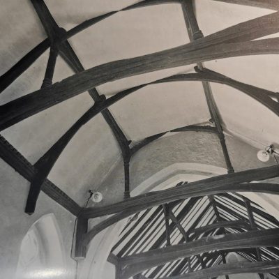
4. St Bene’t’s Church (11th century tower)
Still standing, its Anglo-Norman tower—recorded in Capturing Cambridge—may be the oldest building in Cambridge. It illustrates early stone building traditions, parish organisation, and long-term continuity of worship.
5. St Radegund’s Nunnery (later Jesus College)
Established in the 12th century, the convent represented both female monastic life and medieval religious diversity. Jesus College’s foundation in 1496 transformed the site but preserved its boundaries.
Capturing Cambridge entries on Jesus Lane reflect this layered history.
6. Augustinian, Dominican, and Franciscan friaries
Although dissolved later, their medieval presence shaped Downing Street, Bene’t Street, and Sidney Street. Capturing Cambridge records surviving fragments, archaeological digs, and historical documentation.
C. Markets, Streets, and Urban Life
7. Market Hill—commercial heart of medieval Cambridge
Referenced across Capturing Cambridge entries, Market Hill hosted livestock trading, grain sales, craftsmen’s stalls, and periodic fairs. Its centrality demonstrates town–country interdependence.
8. Bridge Street and Magdalene Bridge
These remain medieval transport corridors that connected Cambridge to fenland trade routes. Capturing Cambridge building histories identify medieval timber-framed structures, shopfronts, and plots.
9. Inns, alehouses, and lodging spaces
Medieval travellers, clergy, merchants, and students required hospitality. Capturing Cambridge entries reference early inn sites later rebuilt in the 17th–19th centuries, showing continuity of social geography.
D. Villages, Land Use, and Rural Society
10. Croxton deserted medieval village
A major archaeological site referenced in Capturing Cambridge, Croxton demonstrates how some medieval villages declined due to demographic contraction, enclosure pressures, or economic restructuring.
11. Grantchester, Histon, Cottenham, and fenland villages
While Capturing Cambridge focuses more heavily on later centuries, many village street plans, moats, ridge-and-furrow field patterns, and parish boundaries date from before 1500. These reflect stable rural life shaped by agriculture.
12. Manorial estates and halls
Cambridgeshire’s medieval economy relied on manor courts, tenant obligations, and estate management. Capturing Cambridge entries on former manor house locations preserve names, field boundaries, and archaeological traces.
E. Cambridge University and Intellectual Life (late medieval expansion)
13. Peterhouse (1284) and the growth of collegiate Cambridge
Although founded earlier than 1400, Peterhouse expanded during the 14th–15th centuries, influencing surrounding streets and residences.
14. King’s College (1441), Queens’ College (1448), St Catharine’s (1473), and Jesus (1496)
These institutions—referenced indirectly in Capturing Cambridge—redefined landholding, architecture, patronage networks, and labour demands.
15. Schools, scholars, and book trade
While few physical structures survive intact, Capturing Cambridge street entries indicate where medieval scholars lodged, copied manuscripts, or purchased writing materials—foreshadowing the academic economy that would flourish later.
F. War, Law, Conflict, and Political Identity
16. The Anarchy (1135–1153)
Cambridgeshire—like much of England—experienced fluctuating allegiances and burdens of military provisioning. Castles and town defences reveal lasting impact.
17. Peasants’ Revolt (1381)
Although centred in Essex and London, unrest reached Cambridgeshire. Capturing Cambridge records affected manors, churches, and officials whose authority was challenged during the uprising.
18. Wars of the Roses (1455–1487)
Cambridgeshire families participated politically and economically, influencing inheritance, estate consolidation, and local governance.
III. Themes Emerging from 1066–1500
1. Continuity of settlement and landscape
Many streets, villages, parish boundaries, and agricultural fields visible today originated in the medieval era.
2. Centrality of religion
Monasteries, parish churches, and religious guilds organised education, charity, memory, and community identity.
3. Emergence of Cambridge as a university town
Collegiate foundations established the city as a long-lasting centre of learning, patronage, and cultural prestige.
4. Blended commercial and agrarian economy
Wool, grain, livestock, river trade, and handicrafts sustained both urban and rural life.
5. Architectural layering
Later Georgian, Victorian, and modern structures often rest upon medieval street grids and building foundations—documented in Capturing Cambridge.
6. Social hierarchy and lived experience
Lords, clergy, merchants, scholars, artisans, labourers, and peasants participated in a complex but interdependent social world.
IV. The Role and Limitations of Capturing Cambridge for Medieval Study
Capturing Cambridge is invaluable because it preserves:
– building histories with medieval origins
– archaeological reports revealing monastic and domestic sites
– village and parish continuity
– street-name memory linking to early settlement
– community contributions documenting place-based identity
However, limitations include:
– limited surviving domestic medieval buildings
– fewer narrative sources before the 16th century
– fragmented archaeological evidence
– interpretive reliance on secondary historical research
Even so, Capturing Cambridge offers critical spatial and cultural connections between medieval and modern Cambridgeshire.
V. Conclusion — Medieval Foundations of Modern Cambridgeshire
Between 1066 and 1500, Cambridgeshire transformed into a county defined by parish networks, agricultural villages, monastic estates, growing markets, and a rising university culture. Its medieval landscapes—streets, colleges, waterways, bridges, marketplaces, churches, and village forms—still shape the county today. Capturing Cambridge preserves these foundations by documenting visible and hidden traces of medieval life, enabling residents and researchers to reconnect with the deep past.
The medieval centuries were not static or isolated—they were dynamic, resilient, and globally connected through trade, religion, learning, and politics. Understanding this era reveals how Cambridgeshire’s long history continues to structure its present identity, heritage, and sense of place.
Contribute
Do you have any information about the people or places in this article? If so, then please let us know using the Contact page or by emailing capturingcambridge@
License
This work is licensed under CC BY-NC-SA 4.0![]()
![]()
![]()
![]()