Search by topic
- archaeology
- Building of Local Interest
- chapel
- charity
- church
- crime
- dressmaker
- fire
- Great Eastern Railway
- Listed building
- Mapping Relief
- medieval
- oral history
- poverty
- Public House
- Religious House
- Roman
- scholar
- school
- Then and Now
- tudor
- women
- work
- world war one
- world war two
Search by text
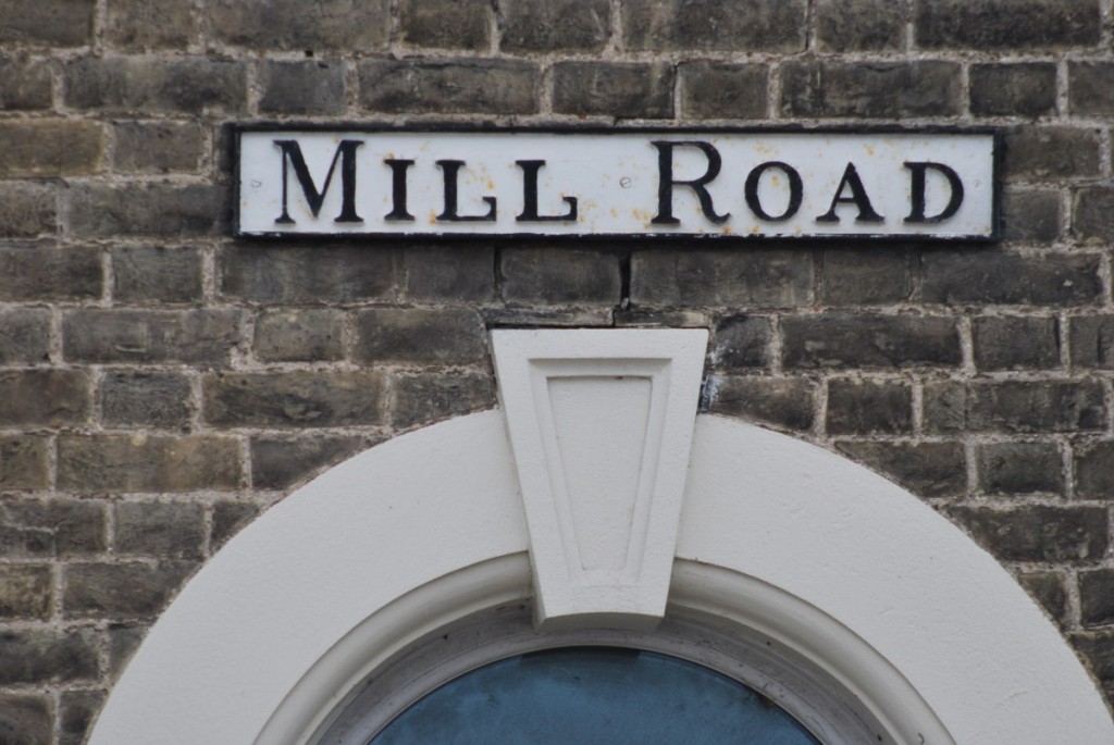
Mill Road Names, Cambridge
Imagine Mill Road without traffic or people. Without houses or shops. Without the railway bridge – or the railway line.
Imagine a dusty, empty track leading past corn fields and ending at an isolated farm set in the countryside a mile and a half from the town centre. Beyond the farm the track turns into a footpath that leads to the small village of Cherry Hinton, where even as late as 1945 no-one owned a car.
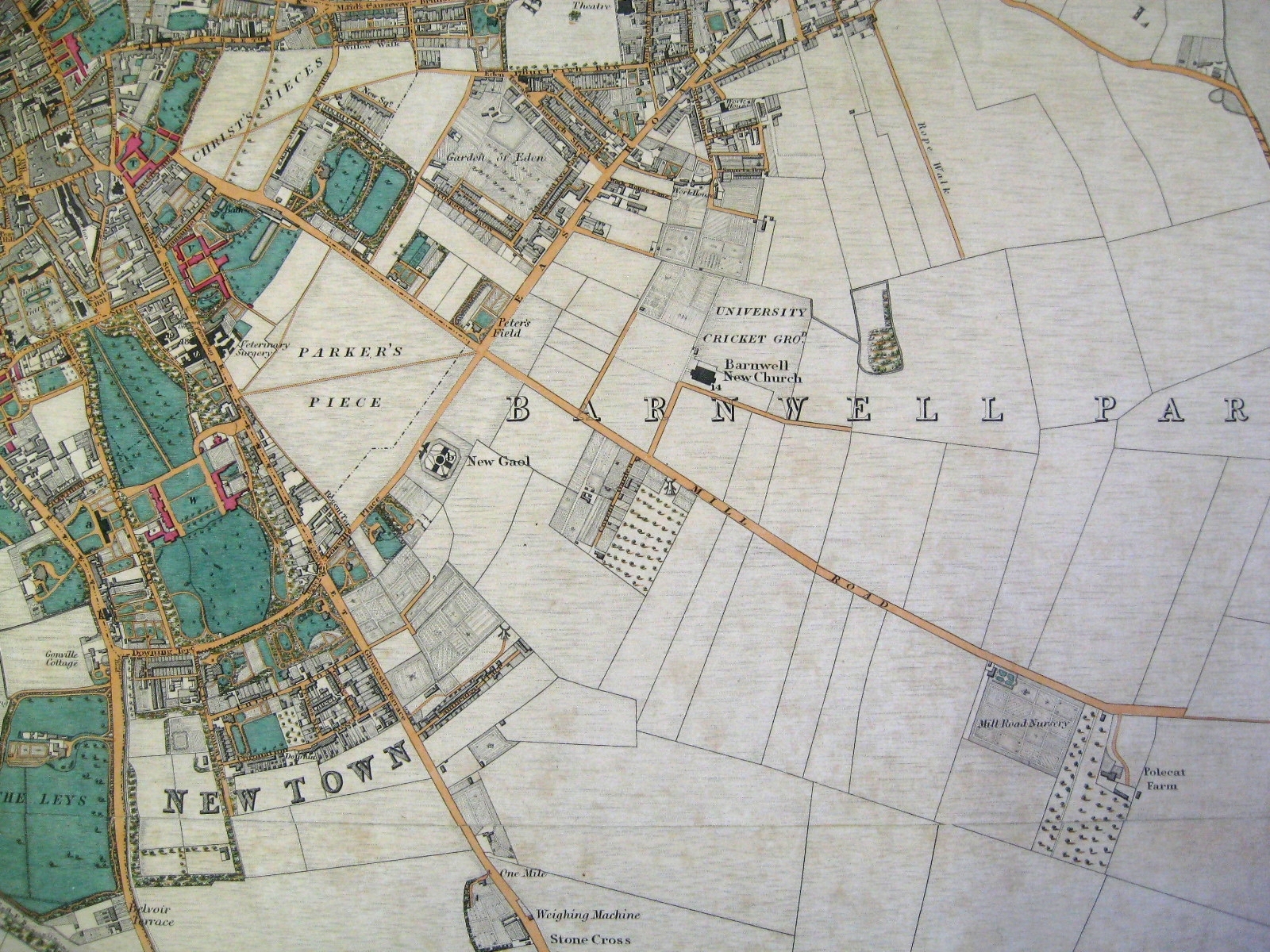
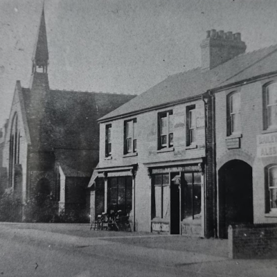
Courtesy of Cambridgeshire Archives
This was Mill Road in 1830. A map shows the farm was called Polecat Farm, and that it lay where Romsey Terrace is today. But Romsey Terrace didn’t exist then. There was only one street on Mill Road with a name – ‘Covent Garden’, a cluster of houses forming a small hamlet next to the windmill that gave ‘Mill Road’ its name.
Mill Road was part of Barnwell, a village outside Cambridge near the junction of East Road and Newmarket Road. In 1801 the population was 252. By 1891 this had risen to 25,091. And many of these lived in new houses built in new streets off the old farm track that had once led out into the fields.
Street Names
Some of the street names provide a link with the 19th century owners of these fields. Only a few were colleges, and these lay near to Parker’s Piece: Collier Road , Mackenzie Road (Bishop in Central Africa, friend of Livingstone), Guest Road (Master of Caius College), Willis Road (author of the ground breaking ‘Architectural History’ of Cambridge University), Perowne Street (Master of Corpus), Mawson Road (Master of Corpus, Bishop of Ely), Tenison Road (Archbishop of Canterbury), Glisson Road (member of Caius, 17th century lecturer on anatomy) were all associated with Corpus Christi or Caius College.
The streets developed by the colleges are still recognisable today. The houses were built to rent to the new Victorian middle classes, and designed to last as the colleges sought a guaranteed investment stretching into the future.
Elsewhere smaller terraces were built by private developers. Much of the land between East Road and Mill Road was acquired by a Chemist, Joseph Sturton, in the 1870s, and became known as ‘Sturton Town’. Sturton laid down roads and divided the fields into plots where were then sold to local builders – each builder probably erecting only two or three houses. A previous owner of the land Sturton bought was Baron Gwydir, hence ‘Gwydir Street’.
Romsey Town
Across the bridge in Romsey Town the area took its name from the 19th century Romsey Cottage, today a mock Tudor mansion known as Romsey House near Coleridge Road (named after the poet, a student at Christ’s College, owners of much of the land the road stands on).
The first builders, rather than Colleges, are commemorated in Romsey. Charles (Charles St) was the son of Charles Kidman, as was David (David St). Francis Thoday acquired much of the land in the area at a sale in 1879 – hence Thoday Street, and Catherine Street, after his daughter in law.
Elsewhere in Romsey, Ross Street was first known as Rifle Butt Row because it led to the Butts on Coldhams Common (still there – have you climbed them ?). The later name came because Ross was a champion shot.
And Romsey also celebrates the Empire that flourished when the area was developed between 1880 and 1910. Montreal and Natal Roads are reminders of days when Britain ruled from North America to Africa; while Malta, Cyprus, Suez, Madras, Hobart were all ports on the way to Australia.
These streets were all marked on the map by 1901. Seventy years earlier the there were no streets, only fields. The names given to the streets give a small glimpse of the period and some of the people who built the houses that we live in today.
Allan Brigham, September 2012.
With thanks to ‘Cambridge Street Names’: Gray & Stubbings. CUP 2000.
Sources
- Book
- Cambridgeshire Archives
- Maps
Projects
Contribute
Do you have any information about the people or places in this article? If so, then please let us know using the Contact page or by emailing capturingcambridge@
Licence
This work is licensed under CC BY-NC-SA 4.0![]()
![]()
![]()
![]()