Search by topic
- archaeology
- Building of Local Interest
- chapel
- charity
- church
- crime
- dressmaker
- fire
- Great Eastern Railway
- Listed building
- Mapping Relief
- medieval
- oral history
- poverty
- Public House
- Religious House
- Roman
- scholar
- school
- Then and Now
- tudor
- women
- work
- world war one
- world war two
Search by text
 1898 OS map: Chalk Pit and site of Robin Hood tree north of Royston
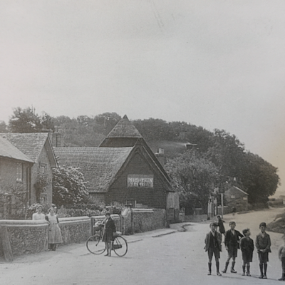
Robin Hood Tree and Chalk Pit, Kneesworth
History of Chalk Pit
In 1923 W M palmer wrote:
The most frequent walk we took was along the Kneesworth Road as far as the turnpike, or Robin Hood’s tree. The turnpike stood a little on the Royston side of the Ashwell Street and was not done away with until 1878. The Robin Hood tree stood on the right had side of the road near the chalk pit. It was an ancient white-thorn tree, which 45 years ago ha already split into three and has now quite disappeared. The tradition was handed down by each generation of schoolboys was, that it had grown out of the shaft of an arrow which Robin Hood had shot from Linloe Hill, Litlington. This was, of course, an impossible shot, but the name for the locality is an old one. On old ordnance maps the name Robin Hood appears across the road which runs parallel to the main road on the Litlington side, was once known as Robin Hood Way and may be still.
Contribute
Do you have any information about the people or places in this article? If so, then please let us know using the Contact page or by emailing capturingcambridge@
Licence
This work is licensed under CC BY-NC-SA 4.0


