Search by topic
- archaeology
- Building of Local Interest
- chapel
- charity
- church
- crime
- dressmaker
- fire
- Great Eastern Railway
- Listed building
- Mapping Relief
- medieval
- oral history
- poverty
- Public House
- Religious House
- Roman
- scholar
- school
- Then and Now
- tudor
- women
- work
- world war one
- world war two
Search by text
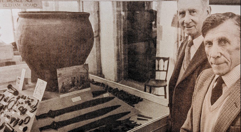 Arthur Houghton and brother William with part of Bronze hoard they found in 1959
Cambridgeshire in prehistoric times
Cambridgeshire in Prehistoric times
This is an edited AI generated summary of the evidence available on Capturing Cambridge for events and developments in Cambridgeshire during the prehistoric period. As such it will be periodically updated and checked as new material is uploaded. Comments are welcome.
Prehistoric Cambridgeshire Before the Roman Invasion: A Detailed Historical Study Through Capturing Cambridge
Long before the arrival of the Romans in AD 43, the landscape now known as Cambridgeshire was home to thousands of years of human activity. From Paleolithic hunter-gatherers to Neolithic farmers, from Bronze Age barrow builders to Iron Age hillfort communities, prehistoric Cambridgeshire developed evolving social structures, technologies, belief systems, and settlement patterns. Although no written sources survive from this period, archaeological findings, environmental evidence, landscape features, and curated heritage material — some of which appears in Capturing Cambridge — help reconstruct daily life, mobility, ritual, and identity across more than 10,000 years.
This report summarises prehistoric Cambridgeshire up to the Roman invasion, drawing on themes, archaeological references, and landscape histories represented within the Capturing Cambridge project. Because the prehistoric era left few standing structures, Capturing Cambridge contributes understanding primarily through place-name research, artefact reports, excavation summaries, and environmental interpretation.
I. Why Prehistory Matters in Cambridgeshire History
Five major long-term developments shaped life before the Romans:
1. Receding Ice Age landscapes (after c. 12,000 BC)
Rising temperatures transformed tundra into woodland, grassland, and habitable fen-edge ecosystems.
2. Hunter-gatherer lifeways
Mobile communities adapted to rivers, wetlands, and seasonal food resources.
3. The Neolithic farming transition (c. 4000 BC)
Crop cultivation, animal domestication, and permanent settlement reshaped daily life.
4. Bronze and Iron Age social complexity (2500 BC – AD 43)
Metalworking, trade networks, ceremonial landscapes, and hillforts emerged.
5. Continuity of settlement
Many later villages, fields, and routeways developed from prehistoric origins.
Capturing Cambridge entries help identify where these prehistoric traces intersect with modern streets, buildings, and neighbourhoods.
II. Case Studies from Capturing Cambridge (Prehistoric Evidence)
Because Capturing Cambridge primarily documents later historical periods, prehistoric references appear most often in archaeological notes attached to street or village histories. Nonetheless, several significant examples emerge.
A. Paleolithic and Mesolithic Landscapes
1. Early activity along the River Cam
Capturing Cambridge includes references in local histories noting flint scatters and early tool discoveries near Grantchester Meadows and river terraces. These finds suggest seasonal hunting and fishing camps exploiting wetland resources.
The river corridor later influenced medieval, early modern, and modern settlement — demonstrating continuity of human attraction to waterways.
2. Fen-edge occupation
Village histories — particularly for Waterbeach, Cottenham, and Horningsea — note archaeological material indicating Mesolithic presence. The fenland provided fish, birds, plants, and transportation routes that sustained early communities.
B. Neolithic Farming and Ritual Landscapes
3. Settlement continuity beneath modern streets
Capturing Cambridge entries for Cherry Hinton and surrounding areas reference Neolithic pottery and worked flints uncovered during construction, suggesting long-term occupation long before documented history.
4. Long-distance movement of materials
Although not explicitly detailed in Capturing Cambridge, some entries referencing prehistoric excavation note stone objects sourced from regions far beyond Cambridgeshire — evidence of trade, exchange, and social networks.
5. Burial and ceremonial evidence
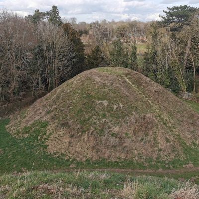
While most formal records lie in archaeological archives, Capturing Cambridge occasionally notes barrow remains or place-name references linked to prehistoric ritual landscapes, indicating shared memorial sites across generations.
C. Bronze Age Social and Economic Development
6. Field systems and agricultural infrastructure
Some Capturing Cambridge village profiles reference aerial photography and cropmarks showing Bronze Age field boundaries or droveways, especially near the fen edge. These systems reflect organised farming, livestock management, and territorial identity.
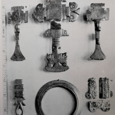
7. Metal artefacts and status objects
Occasional references to bronze spearheads, axes, or personal ornaments found near Cambridge — often mentioned in local histories — point to skilled craftsmanship and expansive trade networks extending across prehistoric Britain.
D. Iron Age Communities and Proto-Urban Development
8. Iron Age farmsteads and roundhouses
Capturing Cambridge building and neighbourhood histories — particularly around Arbury, Chesterton, and Trumpington — sometimes mention excavated postholes, pottery, or grain storage pits beneath modern housing estates. These findings reveal thriving Iron Age settlements near where people continue to live today.
9. Tribal territory and governance
Although rarely directly stated in Capturing Cambridge entries, Cambridgeshire formed part of the territory of the Iceni and possibly the Catuvellauni. This political context shapes interpretation of Iron Age material found beneath streets and fields recorded in the project.
10. Trade, craft, and social networks
Iron Age pottery types referenced in some village excavation summaries show links across East Anglia, indicating economic cooperation and shared cultural styles.
III. Themes Emerging from Prehistoric Cambridgeshire
1. Landscapes shaped human life — and still do
Rivers, gravel terraces, clay uplands, and wet fenland determined where people lived, hunted, farmed, worshipped, and traveled. These same features continue influencing settlement today.
2. Continuity beneath the modern city
Although Cambridge appears medieval to the casual observer, prehistoric activity underlies many of its streets, shops, and colleges — visible through developer-led excavations reported in Capturing Cambridge entries.
3. Community adaptation and innovation
Prehistoric societies developed new technologies — from farming to metalwork — in response to changing climate, population, and mobility.
4. The fenland as a defining environment
Capturing Cambridge reinforces the role of the wetlands, which offered both opportunity and challenge, shaping a distinctive regional identity.
5. Archaeology as primary evidence
Without written sources, the prehistoric story of Cambridgeshire must be reconstructed through artefacts, bones, pollen samples, soil layers, cropmarks, and stratigraphy — often summarised in the heritage notes appearing on Capturing Cambridge.
IV. The Role and Limits of Capturing Cambridge for Prehistoric Study
Capturing Cambridge contributes to prehistoric understanding by preserving:
– excavation summaries attached to individual addresses or developments
– heritage descriptions noting underlying prehistoric layers
– village histories referencing earlier occupation evidence
– public memory of landforms, field names, and long-standing pathways
– interpretation of archaeological finds displayed in local museums
However, the platform has limitations:
– prehistoric material is fragmentary and often incidental
– most detailed reports exist in academic or archaeological archives
– fewer entries cover rural fenland than central Cambridge
– prehistoric remains are buried and invisible to modern residents
Even so, Capturing Cambridge situates prehistoric archaeology within lived contemporary space — allowing communities to recognise the depth of local human history.
V. Conclusion — The Deep Past Beneath Cambridgeshire
Cambridgeshire’s prehistoric past did not disappear — it became the foundation of everything that followed. Between 4000 BC and AD 43, the region developed farming communities, ritual landscapes, settlement networks, resource-management strategies, and cultural identities that shaped medieval, early modern, and modern life. The river crossing that later became Cambridge mattered long before colleges or markets existed.
Through Capturing Cambridge, we can connect modern pavements, gardens, street names, and village boundaries to the lives of prehistoric people who walked the same ground. Their legacy endures in the shape of the landscape, the organisation of settlements, and the stories revealed through archaeology.
Understanding prehistoric Cambridgeshire restores a sense of time depth — reminding us that the region has been inhabited, adapted, imagined, and rebuilt for thousands of years. The Roman invasion did not mark the beginning of history here — it met a landscape already rich with human experience.
Contribute
Do you have any information about the people or places in this article? If so, then please let us know using the Contact page or by emailing capturingcambridge@
License
This work is licensed under CC BY-NC-SA 4.0![]()
![]()
![]()
![]()