Search by topic
- archaeology
- architecture
- bricklayer
- Building of Local Interest
- carpenter
- church
- crime
- dressmaker
- fire
- Great Eastern Railway
- Listed building
- medieval
- oral history
- Public House
- Rattee & Kett
- Religious House
- Roman
- scholar
- school
- Then and Now
- tudor
- women
- work
- world war one
- world war two
Search by text
 The Toll House and Weighbridge House in the 1920s. Percy Robinson.
The Toll House and Weighbridge, Trumpington
The Toll house and weighbridge on Trumpington High Street
The High Street follows the route from the south to Cambridge. From the 1720s, two turnpike roads merged here: from Barkway (Hauxton Road) and Great Chesterford (Shelford Road) . The tollhouse on the west side of the High Street was built in 1811, with a weighbridge added to its right in 1863.
Trumpington Timeline 1811 on Trumpington Local History website
Then and Now (David Gent) – Trumpington High Street, Toll House and Weighbridge.
In the 1720s, two turnpike roads merged a few yards south of here, one from the Royston direction and the other from the Shelford direction. The toll-house was built in 1811, with a weighbridge added to its right in 1863.
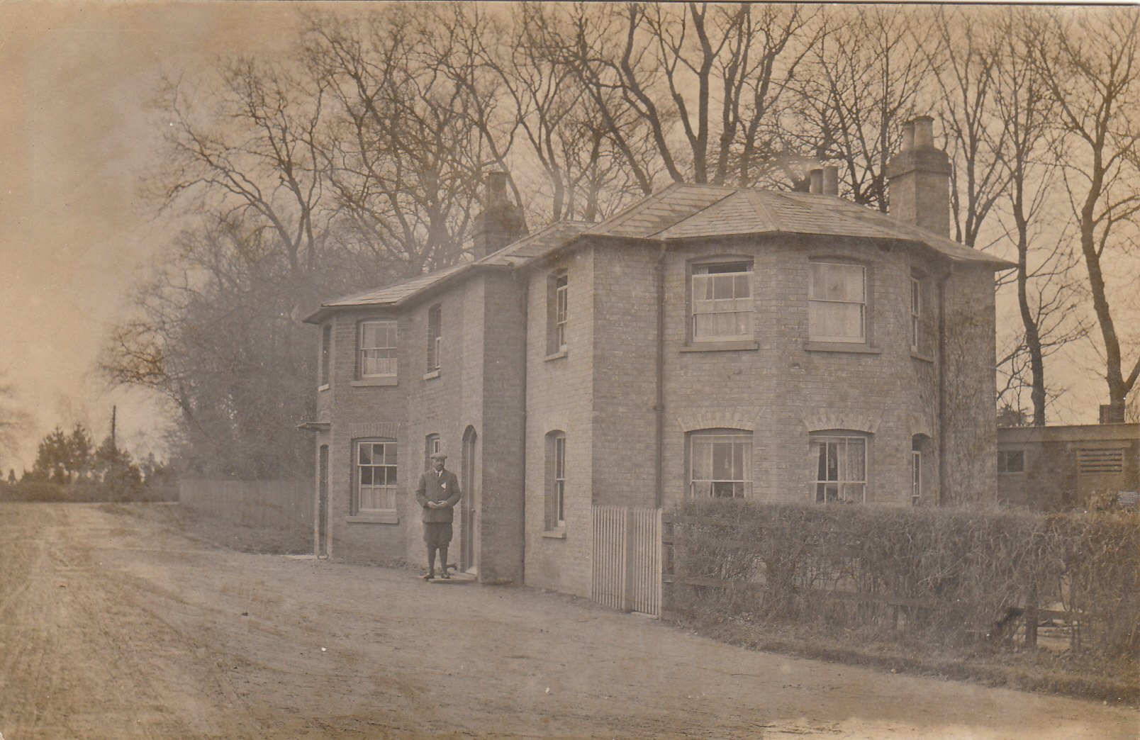
Toll House, Trumpington postmarked 1908
The first picture is from a postcard posted marked 1908. It was posted to a Miss Ferguson at 55 Mill Road, Cambridge. The text made me smile. It reads…. If fine tomorrow I might walk into Kings, if so would call round to see if the “milkman” has been, unless it would be inconvenient to you, then perhaps you would send me a P.C., yours Edith. Yes, the word milkman really is in in inverted commas, I wonder who he really was? Also, an amazing postal service back then, sending a postcard and expecting a reply in time to sort out plans for the following day!
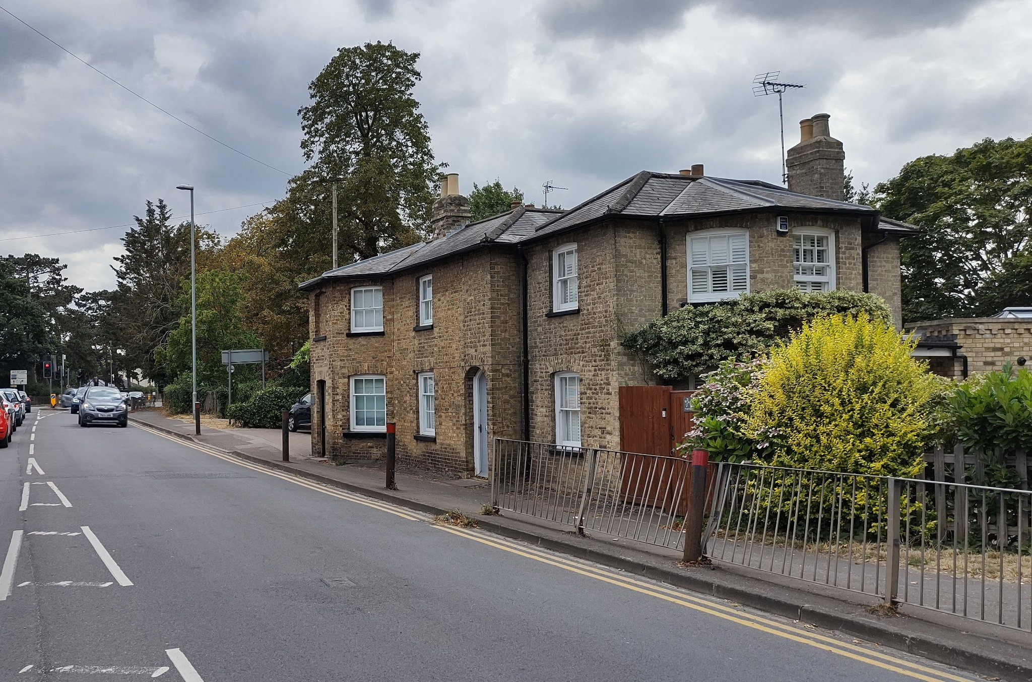
Toll House, Trumpington (photo DG 2022)
Second picture taken July this year
Extracts from an Act of 1724 establishing the Cambridge Turnpike by Ken Fletcher
Whereas that part of the and antient (sic) Road leading from London to Cambridge which lies in the several parishes of Foulmire, Thriplow, Newton, Harlton, Hawkston (sic) and Trumpington, in the County of Cambridge and in the Liberty and Town of Cambridge, to the end of the pavement in Trumpington Street in the said town of Cambridge, about seven miles in length. Is become very ruinous, and at many Times of the Year almost impassable, by reason of the great Quantity of Provisions continually conveyed for the life of the City of London and the other great and heavy loads drawn through the same, insomuch that it has become very dangerous to all persons travelling that way.
The Act goes on to propose a Turnpike scheme but then continues:
And whereas, there is certain Road leading from Royston in the said County of Cambridge, to Cambridge aforesaid through the parishes of Melbourn, Meldreth, Shepreth, Foxton and Harlton and jouneth with the said great Road leading from London to Cambridge in the parish of Hawkston aforesaid which being very deep and miry in the Wet Season of the Year is very troublesome to Persons travelling that Way and requires also great Strength of horses and carriages for the using of the said Road
This section goes on to exempt travellers from Royston via Melbourn from tolls as the turpike road “will be of little or no Service to them”
Contribute
Do you have any information about the people or places in this article? If so, then please let us know using the Contact page or by emailing capturingcambridge@
License
This work is licensed under CC BY-NC-SA 4.0![]()
![]()
![]()
![]()