Search by topic
- archaeology
- Building of Local Interest
- chapel
- charity
- church
- crime
- dressmaker
- fire
- Great Eastern Railway
- Listed building
- Mapping Relief
- medieval
- oral history
- poverty
- Public House
- Religious House
- Roman
- scholar
- school
- Then and Now
- tudor
- women
- work
- world war one
- world war two
Search by text
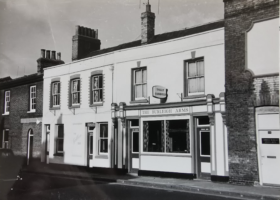 Burleigh Arms, Newmarket Road (MoC)
Newmarket Road – Mapping Relief
Newmarket Road - Mapping Relief
The Cambridge Charity Organisation Society was founded in 1889 and aimed to help the ‘really deserving poor’. At Cambridgeshire Archives, we have nearly 3000 applications for relief from those within Cambridge and beyond. A recent project aimed to look at the demographics of those applying; looking at the variety of occupations within the city as well as the age spread. These were plotted across the city and the data here shows the numbers of applicants per street in Cambridge whilst including information regarding their occupation and age. For access to these records or any further questions, please contact Cambridgeshire Archives on cambs.archives@cambridgeshire.gov.uk
The Black Lion, Newmarket Road (also Pope’s)
The Butcher’s Arms, Newmarket Road
The Earl of Durham, Newmarket Road
The George and Dragon, Newmarket Road
The George and Dragon Yard, Newmarket Road
The Jolly Butcher, Newmarket Road
The Race Horse, Newmarket Road
Shamrock Passage, Newmarket Road
Sturbridge Terrace, Newmarket Road
Tabernacle Row, Newmarket Road
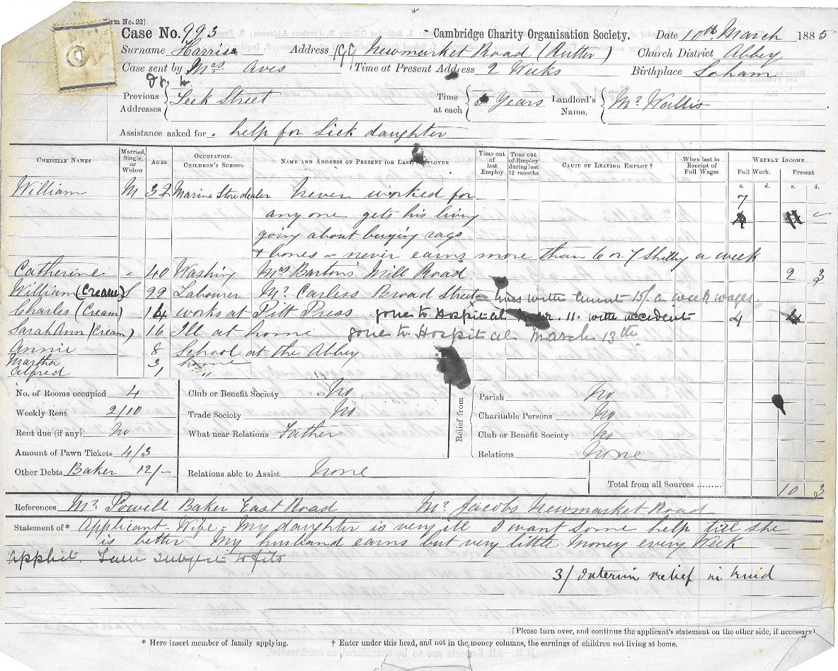
William Harris 199 Newmarket Road 1885
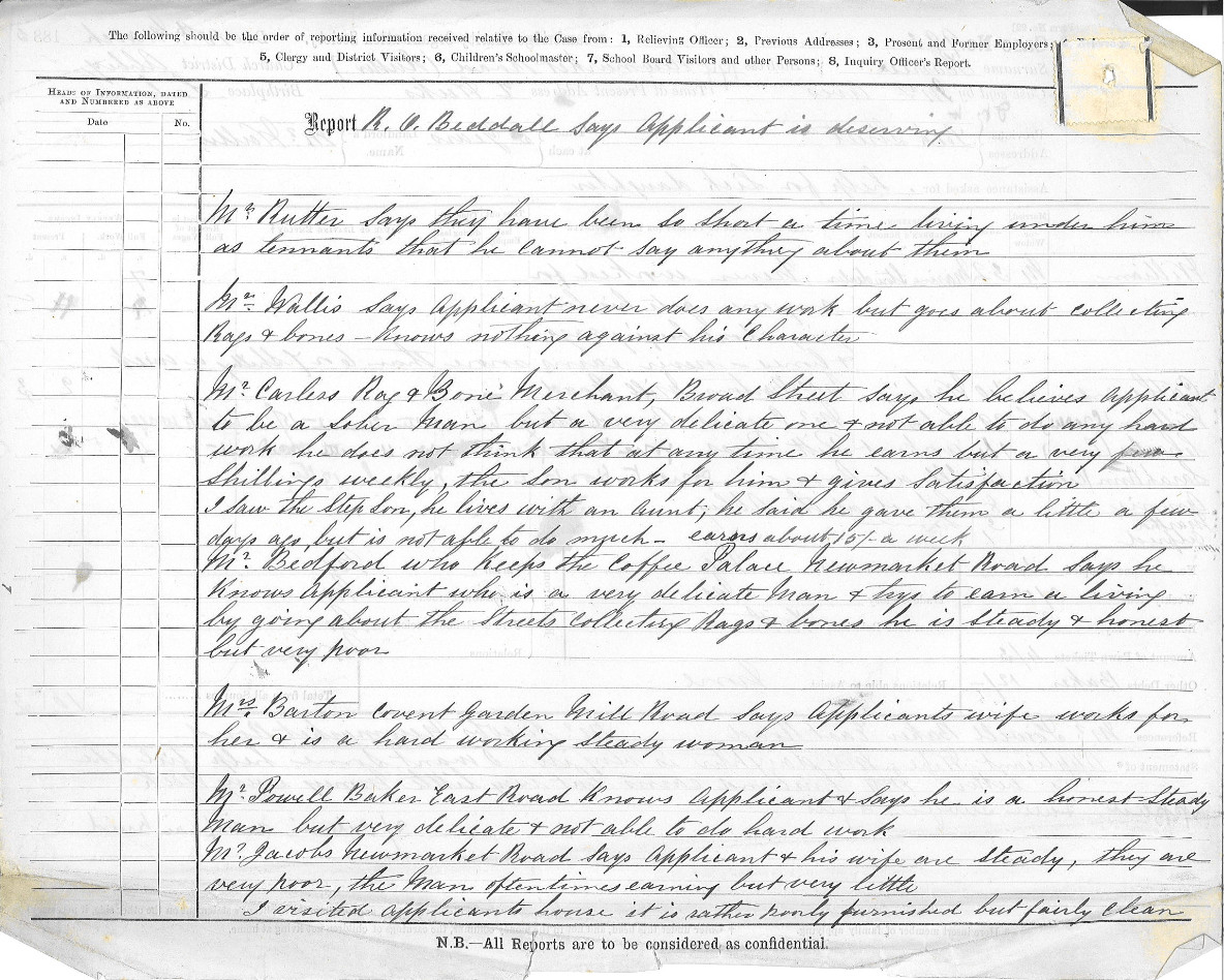
William Harris 199 Newmarket Road 1885
In 1881 William and his wife Catherine are living at 3 Shamrock Passage, next to 70 Newmarket Road.
In 1891 William and Catherine are living at 8 Leek Street off Newmarket Road.
Contribute
Do you have any information about the people or places in this article? If so, then please let us know using the Contact page or by emailing capturingcambridge@
Licence
This work is licensed under CC BY-NC-SA 4.0