Search by topic
- archaeology
- Building of Local Interest
- charity
- church
- crime
- dressmaker
- fire
- Great Eastern Railway
- Listed building
- Mapping Relief
- medieval
- oral history
- poverty
- Public House
- Rattee & Kett
- Religious House
- Roman
- scholar
- school
- Then and Now
- tudor
- women
- work
- world war one
- world war two
Search by text
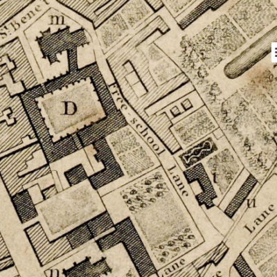
 14th century Cambridge map from 'Outside the Barnwell Gate' by H P Stokes, 1915'
King’s Ditch
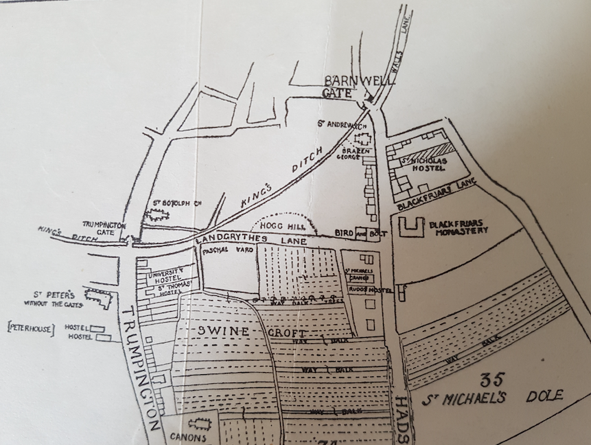
History of the King's Ditch
There is a detailed description of the archaeology of the King’s Ditch as uncovered during the Grand Arcade excavations: The King’s Ditch: from Anarchy to alleyway by Craig Cessford in ‘Medieval to modern suburban material culture and sequence at Grand Arcade, Cambridge‘ 2019.
In 1267 Henry III was at Cambridge actively fortifying the town during a period of war against the Barons.
Hist. Univ. Camb by T Fuller, ed. Prickett and Wright, pp. 40:
Only the south and east of the town lay open, which the King intended to fortify. In order whereunto he built two gates, Trumpington Gate by St Peter’s Church, now ruined, on the south; Barnwell Gate by St Andrew’s Church now decayed on the east. And because gates without walls are but compliments in matters of strength, he intended to wall the town about, if time permitted him. Meantime he drew a deep ditch (called King’s Ditch at this day) round about the south and east parts of Cambridge. Presently news is brought to him, that Gilbert, earl of Clare, had seized on the chief city of the realm. No policy for the King to keep Cambridge and lose London the while. Thither marched he in all haste with his army, and may be said to carry the walls of Cambridge away with him, the design thereof sinking at his departure.
See Defending Cambridge, Mike Osborne, (2013) for a detailed description of the importance of the King’s Ditch and its origins being possibly pre-Norman Conquest and built at the direction of King Edward together with the tower of St Bene’t’s church.
According to the 1959 Royal Commission on Historical Monuments Survey of Cambridge, the King’s Ditch was the original boundary and defensive ditch to the S and E of the old town, possibly pre-Conquest and remodelled in the 13th century.
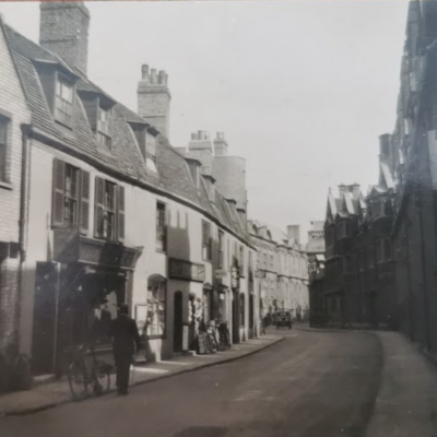
Little visible remains; in Richard Lyne’s street map of 1574 the ditch is shown and can be traced along the line of the modern roads starting at the Cam with Mill Lane, running along Pembroke Street, across the site of the old Botanic Gardens, along St Tibb’s Row and Hobson Street, across the fellow’s garden of Sidney Sussex College and along Park Street to rejoin the river nearly opposite the Pepys Building of Magdalene College.
The only surface remains are near the squash court in the Fellows’ garden, Sidney Sussex College.
There was a ditch north of the Cam of which no surface remains survive. It was possibly a stream that had been canalised.
In 1960 the City of Cambridge published a Report on the Main Drainage of the City. This included a review of historical drainage including the King’s Ditch. It notes that it was constructed in 1215 on the orders of King John as a defence line; further development happened in 1267 under Henry III. However it mainly functioned as a public open sewer. During the 14th and 15th centuries there were numerous complaints and in 1445 annual cleaning of the ditch was proposed. In 1610 there was an attempt to flush the Ditch but this was not very successful and a further survey was carried out in 1629. Gradually the Ditch was culverted; one of the last lengths to be so covered was that adjacent to park Street which was open until c.1800.
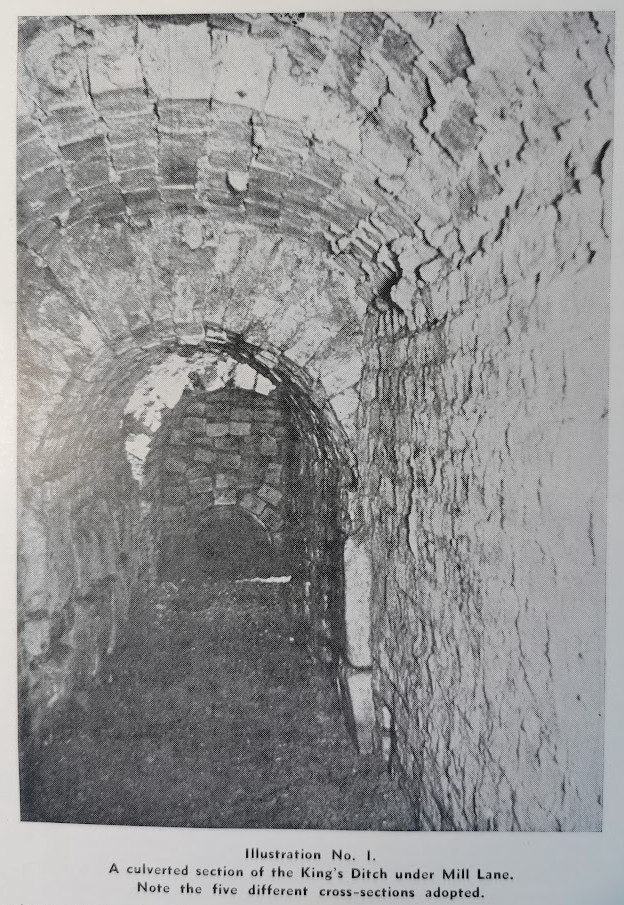
King’s Ditch under Mill Lane
https://library.oxfordarchaeology.com/3975/
Contribute
Do you have any information about the people or places in this article? If so, then please let us know using the Contact page or by emailing capturingcambridge@
License
This work is licensed under CC BY-NC-SA 4.0![]()
![]()
![]()
![]()