Brazen George Inn, St Tibb’s Row
A 14th Century Inn
The Brazen George was a Hostel or Inn for students in medieval times. In the reign of Henry VI (1445-6) it became the property of Geoffrey Neville, who had sold his house (where students lived) to the King for the site of King’s College, on condition of another equally good location being found for him.

The Brazen George was given to Christ’s College by its third Master (1511-17) Dr Thomas Thompson, who had been a member of Pembroke. It was long used as as a dwelling place for some of the scholars of Christ’s. Thompson also gave the house adjacent to the Brazen George, named after successive tenants ‘Scocroft’s’ and ‘Troilus Atkinson’s’.

A report to Archbishop Laud in 1636 points out that students of Christ’s College are living at the hostel despite University statutes that require them to live in the college.
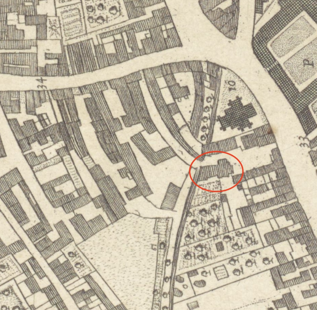
1805
A room in the yard of the Brazen George (most likely 4 St Andrew’s Street) was one of the first places that Methodists met for worship in Cambridge from 1805. As the King’s Ditch ran close by, this early Wesleyan meeting house was known as ‘the Black Ditch’. A Society was formed which by 1811 numbered 80 members and it was decided to build a chapel in Barnwell, at 133 Fitzroy Street.
According to https://www.wesleycam.org.uk/ourhistory.htm:
…a room was hired in the inn yard of “The Brazen George”, on a site opposite to the south-east corner of Christ’s College in St. Andrew’s Street… The room that was hired could accommodate 40 people and was adjacent to, and partly overhung, the putrid waters of the ditch, from which many noxious smells permeated through the floor. By all accounts it was a wretched neighbourhood, matched only in its squalor by its inhabitants; so early Methodism went not simply to those who needed its ministrations, but to those who needed them most.
1868
The part of the Brazen George site on the west side of St Tibb’s Row is sold to be the site of the new YMCA building on Alexandra Street (built on the site of Red Hart Yard in this plan).
Projects
Contribute
Do you have any information about the people or places in this article? If so, then please
let us know using the Contact page or by
emailing capturingcambridge@
Licence
This work is licensed under CC BY-NC-SA 4.0


 not including content on external links as indicated by
 .