Search by topic
- archaeology
- Building of Local Interest
- charity
- church
- crime
- dressmaker
- fire
- Great Eastern Railway
- Listed building
- Mapping Relief
- medieval
- oral history
- poverty
- Public House
- Rattee & Kett
- Religious House
- Roman
- scholar
- school
- Then and Now
- tudor
- women
- work
- world war one
- world war two
Search by text

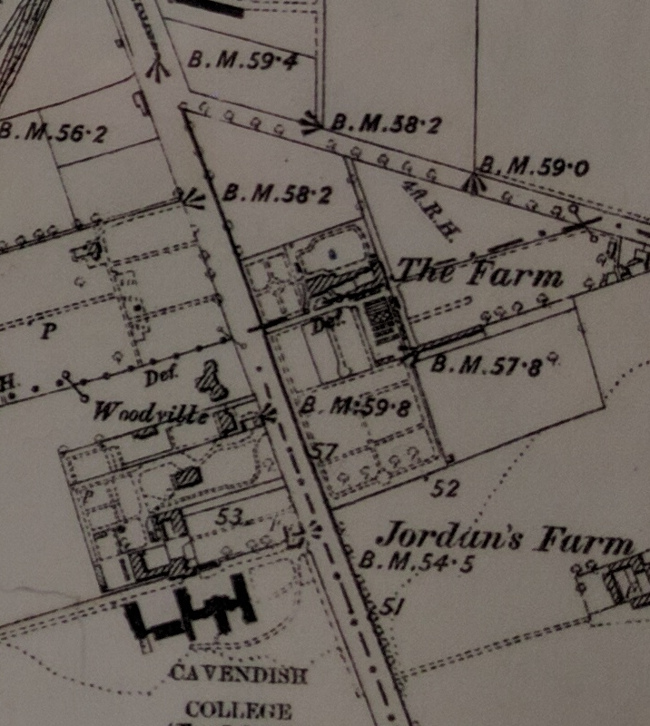
Jordan’s Farm, Hills Road
History of Jordan's Farm
Mid nineteenth century maps show Jordan’s Farm around this location. The farmyard was roughly where Morley School is today and was reached along a track which is today Blinco Grove. On the north side the farm stretched as far as Rathmore Road, and on the south, as far as Cavendish Avenue.
The farm is clearly shown on the 1830 & 1836 OS map of Cambridge though unnamed.
(Source OS maps)
The 1891 census records a Jone’s farm on Hills Road. This could be the same as Jordan’s Farm. There are two households listed:
Henry Dean, 59, farm bailiff
Mary J, 62
William, 23, town postman
Ellen E, 23, daughter in law
Richard H, 1 grandson
and
William J Marshall, 30, agricultural labourer
Hannah, 30
Louisa, R
William J, 1
Contribute
Do you have any information about the people or places in this article? If so, then please let us know using the Contact page or by emailing capturingcambridge@
License
This work is licensed under CC BY-NC-SA 4.0


