Search by topic
- archaeology
- Building of Local Interest
- chapel
- charity
- church
- crime
- dressmaker
- Great Eastern Railway
- Listed building
- Mapping Relief
- medieval
- oral history
- poverty
- Public House
- railway worker
- Religious House
- Roman
- scholar
- school
- Then and Now
- tudor
- women
- work
- world war one
- world war two
Search by text


Queen Edith’s Way, Cambridge
Notes on the history of Queen Edith's Way, Cambridge
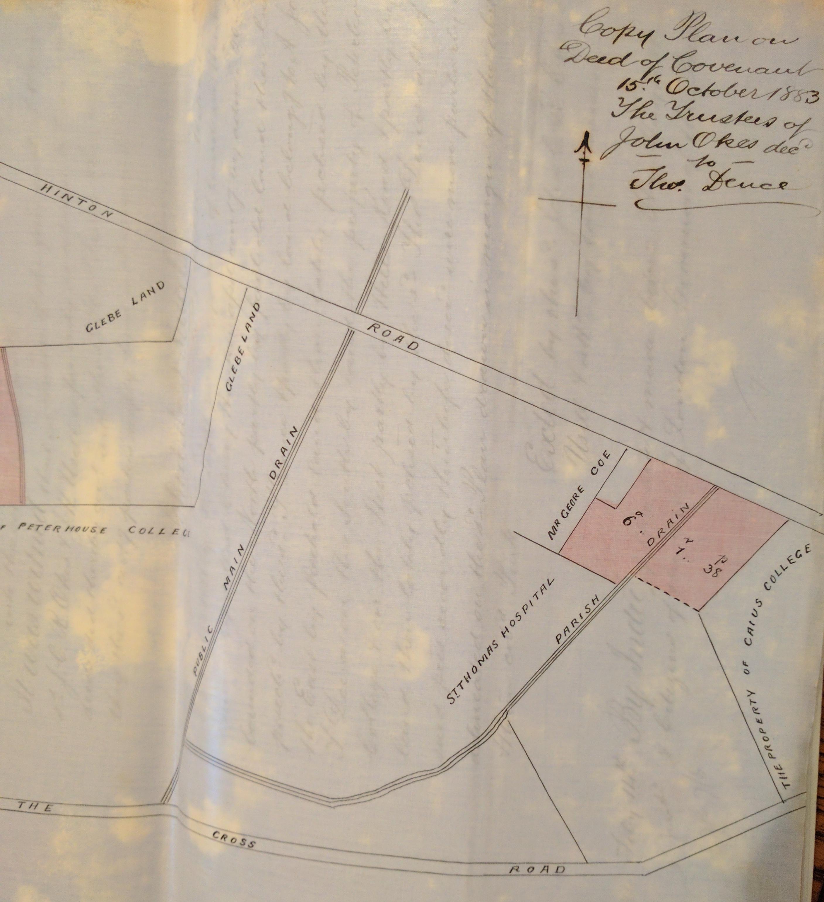
Queen Edith’s Way was originally known as Trumpington Drift (map of 1810). However, the 1883 plans of the conveyance of the Cavendish Estate describe it as The Cross Road.
It was reported in the local paper 2/10/1914 that Trumpington Drift was to be widened and strengthened for military purposes and will be known as Queen Edith’s Way.
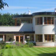
Queen Edith’s Way is one of the most significant streets illustrating Cambridge’s inter-war expansion. Built largely during the 1920s and 1930s, it formed part of a planned suburban development that transformed former agricultural land on the city’s southern edge into a growing residential district. The street reflects the national movement towards healthier suburban living after the First World War, with spacious semi-detached houses, larger gardens, tree-lined roads and improved access to open space.
Its development marked a major shift in Cambridge’s geography. For centuries the city had been concentrated around the historic centre, colleges and riverside districts, but increasing population, rising prosperity and improved transport encouraged outward growth. Queen Edith’s Way became one of the principal routes serving new housing estates that accommodated professional families, university staff, teachers, civil servants and skilled workers who sought modern homes beyond the crowded Victorian terraces nearer the centre.
The street also demonstrates the influence of contemporary planning ideals. Houses were set back from the road, often featuring distinctive Arts and Crafts and neo-Tudor architectural details. The area was designed to provide a pleasant environment while remaining connected to the city by bus routes and improving road networks.
Today Queen Edith’s Way provides valuable evidence of how Cambridge evolved between the wars from a compact university town into a modern suburban city. Its surviving houses, gardens and street layout reveal changing aspirations, patterns of home ownership and the growth of a more mobile middle-class population. As such, it is an important record of the social and physical transformation that shaped twentieth-century Cambridge and continues to define much of the city’s character today.
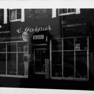
In the 1935 Cambridge Directory a number of houses are listed on the north side of Queen Edith’s Way, between no.39 and Strangeways Road, which had yet to be numbered. The actual locations of following houses has still be identified (Jan 2016):
Garthowen, Treganna, Sunway
The 1935 Directory identifies the following houses by name but not number on the north side of of the road between Strangeways Road and Cherry Hinton Road:
Netherton, Windower, Allandale, Shirley, Kempstonia, Faraway, The Haven, Josselyns
The 1935 Directory has these properties on the south side listed by name but not number from Netherfield House (next to Mowbray Road) to Lime Kiln Road.
S. Thomas, Netherhall Cottages, (pathway to chalk pits), High View, Branksome Dene, Bremerton, Drift House, The Cottage, Three Links, Alnwick, Hillside, Llamberies. Rudine, Salvia, Red Roof, Lyme Villa, The Rosary, Peacehaven.
In June 2008 local concern was reported at the number of planning applications lodged to demolish large residential homes and replace them with blocks of flats. It was feared that the character of the road would be lost.
In April 2009 the Cambridge News reported
Alarm as 32,000 caught speeding: a Cambridge road has been dubbed “Brands Hatch” after 32,000 motorists were clocked speeding in just one week… police found that 75 per cent of vehicles which used the road were speeding and , between 8am and 9am, more than 350 broke the 30mph limit.
In June 2016 a new 20mph limit was imposed.
For more information on the identity of Queen Edith herself read the article by Jeremy Lander:
https://www.frrarchitects.co.uk/wp/wp-content/uploads/2022/06/Queen-Edith_-Jeremy-Lander.pdf
Sources: Cambridge News (Cambridgeshire Collection)
Joan Robertson moved with her husband Stan from 73 Glebe Road to Queen Edith’s Way in 1954. In 2016 she remembered the move and the appearance of the road and other houses:
Projects
Contribute
Do you have any information about the people or places in this article? If so, then please let us know using the
Contact page or by emailing
capturingcambridge@
Licence
This work is licensed under
CC BY-NC-SA 4.0![]()
![]()
![]()
![]() not including content on external links as indicated
by
not including content on external links as indicated
by![]() .
.