Search by topic
- archaeology
- Building of Local Interest
- charity
- church
- crime
- dressmaker
- fire
- Great Eastern Railway
- Listed building
- Mapping Relief
- medieval
- oral history
- poverty
- Public House
- Rattee & Kett
- Religious House
- Roman
- scholar
- school
- Then and Now
- tudor
- women
- work
- world war one
- world war two
Search by text
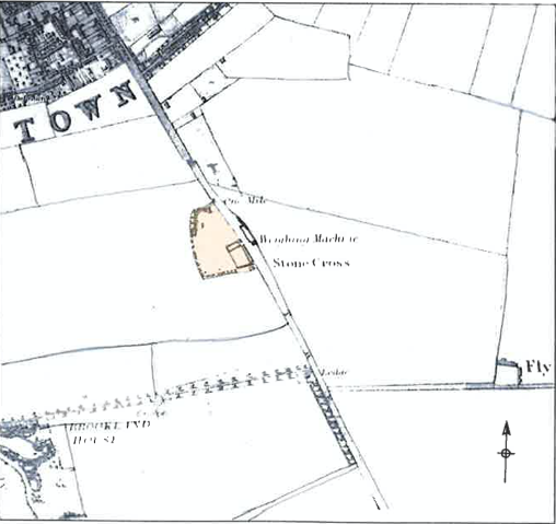 Baker's 1830 map of Hills Road showing weighing machine
Weighing Station, Hills Road
History of Weighing Station, Hills Road
According to ‘A Disorderly House‘ (Barraclough 2018) the position of the toll gate run by the Stumps Cross Trust was relocated several times in order to make it as difficult as possible for traffic to avoid the weighbridge and subsequent charges for using the road into Cambridge from the south. In the 1820s the weighbridge was moved closer to Cambridge to catch traffic coming in from Cherry Hinton.
This location, opposite the modern Flying Pig pub, became a popular site for development in the 1830s. Fruit orchards were planted, a matings built and other dwellings including the inn that would become the Osborne Arms. Station Road was then marked by a field boundary.
Contribute
Do you have any information about the people or places in this article? If so, then please let us know using the Contact page or by emailing capturingcambridge@
License
This work is licensed under CC BY-NC-SA 4.0


