Search by topic
- archaeology
- Building of Local Interest
- charity
- church
- crime
- dressmaker
- fire
- Great Eastern Railway
- Listed building
- Mapping Relief
- medieval
- oral history
- poverty
- Public House
- Rattee & Kett
- Religious House
- Roman
- scholar
- school
- Then and Now
- tudor
- women
- work
- world war one
- world war two
Search by text
Bridge Street
History of Bridge Street
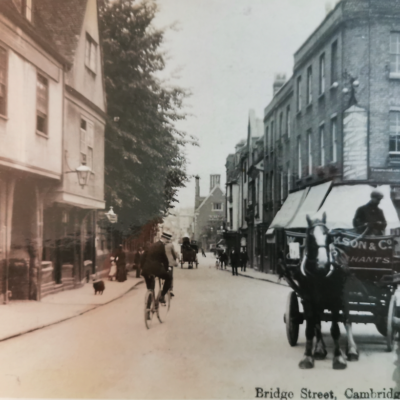
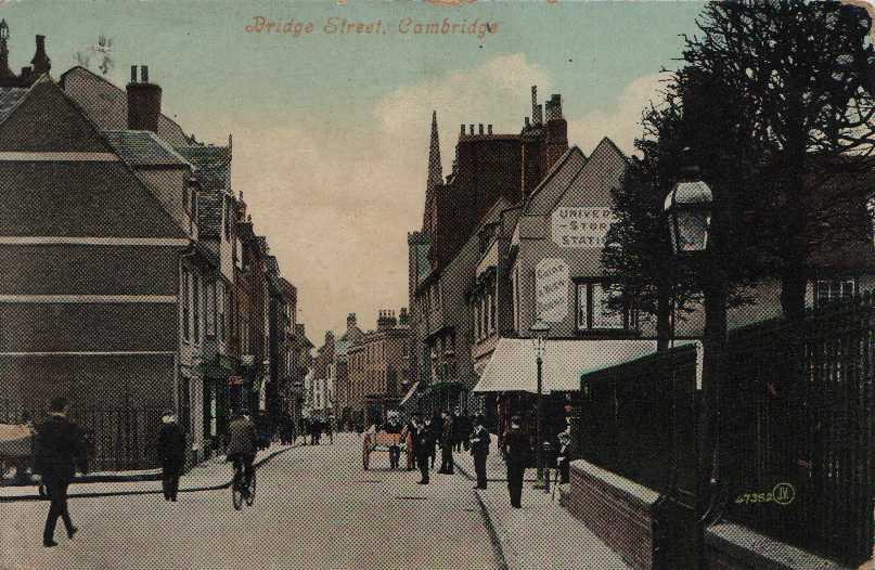
Bridge Street circa 1910. On the right is the entrance to Round Church Street; on the left is St John’s Street. The buildings on the left were demolished by St John’s College some time in the 1930s. They are still marked on the. 1925 OS map.
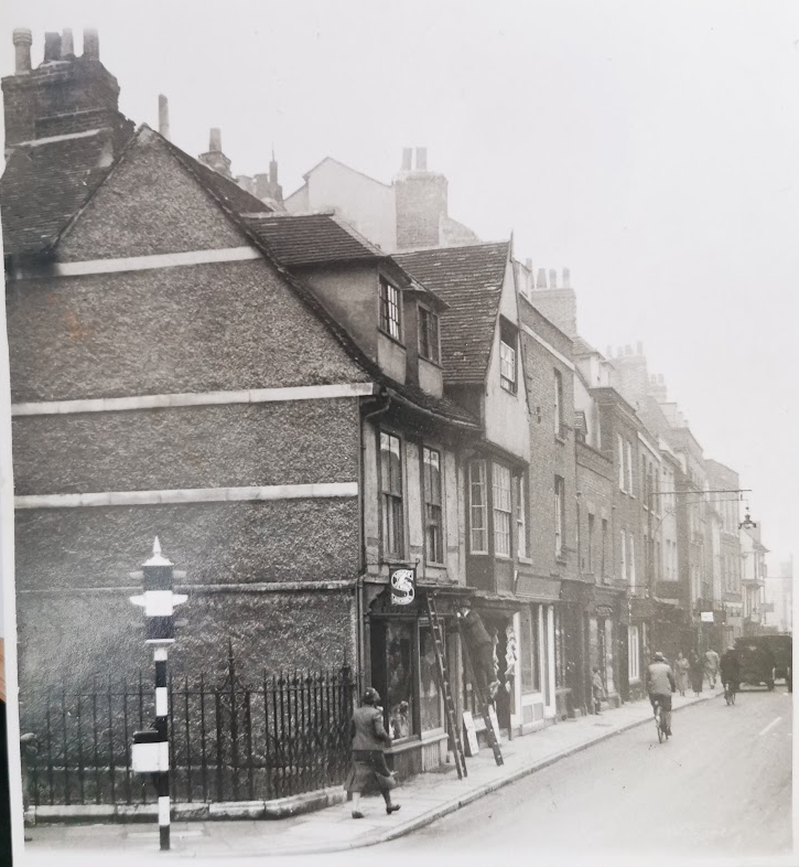
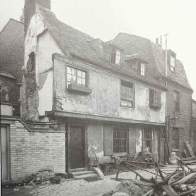
Bridge Street (no.61 in foreground) in 1936 (MoC PB129.82)
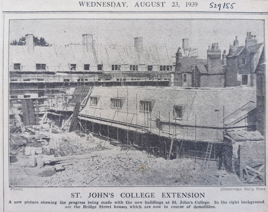
St John’s College extension and demolition of Bridge Street, 1955 (MoC529/55)
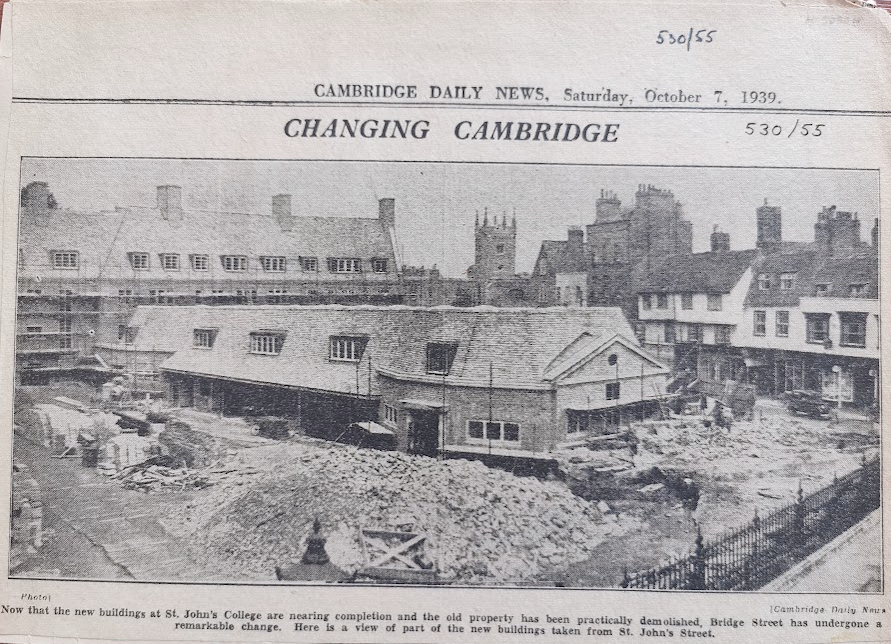
Development of Bridge Street by St John’s College (MoC530/55)
In Roman times the section from the bridge as far as the site of the later Round Church was a causeway. It was part of the Via Devana. (Peter Bryan, Shaping the City, 2008)
A brief description of Bridge Street can be found here:
https://en.wikipedia.org/wiki/Bridge_Street,_Cambridge
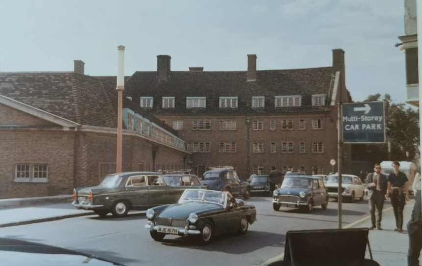
Bridge Street c1970 (MoC P.B.125.82)
Contribute
Do you have any information about the people or places in this article? If so, then please let us know using the Contact page or by emailing capturingcambridge@
License
This work is licensed under CC BY-NC-SA 4.0![]()
![]()
![]()
![]()