Search by topic
- archaeology
- Building of Local Interest
- charity
- church
- crime
- dressmaker
- fire
- Great Eastern Railway
- Listed building
- Mapping Relief
- medieval
- oral history
- poverty
- Public House
- Rattee & Kett
- Religious House
- Roman
- scholar
- school
- Then and Now
- tudor
- women
- work
- world war one
- world war two
Search by text
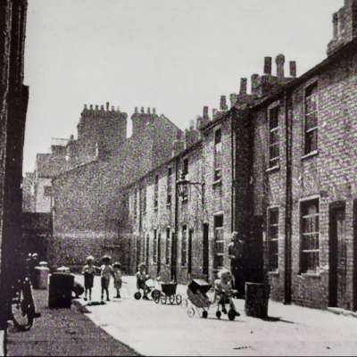
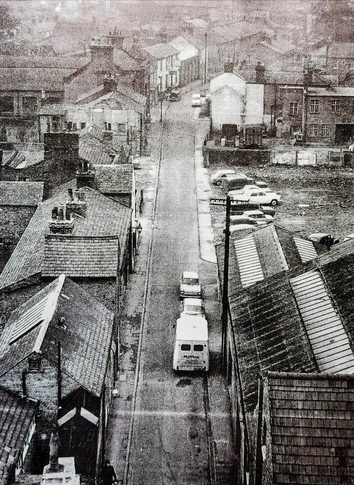 Coronation Street from tower of St Paul's Church, 1964. Demolition in progress. (Cambridge Evening News)
Newtown / New Town area
History of the Newtown area of Cambridge
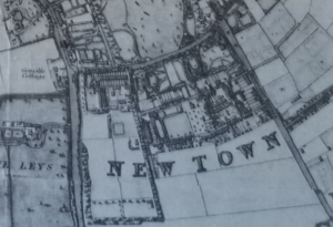
Royal Commission Survey of Cambridge 1959: Downing Terrace and probably Gothic Cottage (Cambridge Chronicle 2 June 1820, 14 jan 1825), now incorporated in the ‘Cross Key’ inn, were just finished before the intensive building of New Town, called New Zealand prior to1822 (ibid 18 May 1822), was begun about 1820, though some houses already existed beside Hills Road (e.g. ibid 12 May, 6 Oct 1820). Union Road is mentioned in 1821 and Nos. 9-14 George IV Street bear the same date. In 1822 Wilkins sold the W part of his garden for a terrace, Annesley Place, now part of Panton Street; the terrace in the same street, just S of Union Road, followed (ibid 19 Aug 1825) and Nos 42-44 (evens) Panton Street are dated 1851 though in appearance rather earlier. By 1825 Coronation Street, Princes Street, Queen Street had begun (ibid 11 June 1824, 13 May 1825); R G Baker’s map of 1830 shows most of the S side of the first built, Saxon Street behind Downing Terrace and Doric Street off it, and a beginning of the N end of Gothic Street. Terrace Lane must have been built soon afterwards. Russell Street is first heard of in 1835 under the name Gwydir Street when an ambitious scheme was announced for development near the ‘new Botanic gardens’ (ibid 13 Feb 1835); a start may have then been made but little was done before the end of the decade and most of the buildings in the street are of 1840 to 1850 and later; Nos. 77-81 are dated 1846, Nos. 84 and 85 1849; Russell Place was built before 1840 (ibid 18 July 1840). development of the area continued after 1850. Much of New Town was ill-built, and as early as 1850 the condition of Terrace lane and Annesley Place was unfavourably commented upon by the Board of Improvement Commissioners (ibid 21 Dec). The area immediately south of Saxon Street is now a slum.
The nickname New Zealand was probably coined because it was at the time such a remote part of town.
See CAS 2005, Cambridge New Town – A Victorian Microcosm by Peter Bryan and Nick Wise. The following notes are taken from this study.
1802 St Giles Enclosures Act (Western or Cambridge Fields)
1807 Eastern or Barnwell Fields Enclosure Act. This bill, according to diarist Henry Gunning, was opposed by the University but passed at the second attempt.
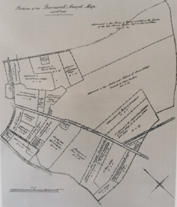
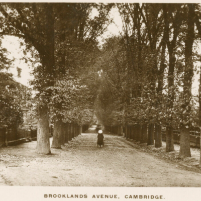
Land on which New Town was built had been part of medieval Ford Field, named after the Trumpington ford by which the London (Trumpington)Road crossed the Vicar’s Brook at the junction of Trumpington Road Brooklands Avenue. North part of this field, lying between Pembroke Street and Lensfield Road, was known as St Thomas Leys, a marshy area used by university men for wild fowling. It was this area that was chosen in 1801 for Downing College. The area south of Lnsfield Road became available for development after 1807 and the lands were allotted in 1811. Of the 80 acres roughly half went to three corporate owners and the other half to ten private owners.
Owners (acreage):
John Lens (4)
Peete Musgrave (2)
Thomas Tomson (5)
Henry Balls (4)
Joseph Truslove (5)
Chris. Pemberton (12)
Cambridge Universtiy (7)
Addenbrooke’s Hospital (2)
Trinity Hall (37)
The earliest development was on land allocated to John Lens, an ex-fellow of Downing College who practised law in London, a plot bounded by Lensfield Road, Hills Road and Panton Street. On this plot was built ‘Lensfield‘ by William Wilkins c.1811 for his own use. Wilkins was a noted architect and former fellow of Caius. He was responsible for the initial design of Downing College and many other buildings in the town. In 1822 part of the grounds of Lensfield were sold off to built Annesley Place, five terrace houses that were together with Lensfield, demolished in 1955 to build the new Chemistry faculty buildings.
In 1810, Lensfield House, was built at the other end of Lens’s plot for Julian Skrine, the banker. This house was demolished in 1885.
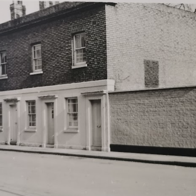
Development at the other end of Lensfield Road began in 1819 on land allocated to Peete Musgrave. This was Downing Terrace, thirteen architect-designed houses, completed by 1820. Musgrave’s son, Thomas, had by now taken on the project; he next changed strategy and built a block of very poor quality housing to the south of Downing Terrace: Saxon Street, Gothic Street, Doric Street and Terrace Lane. Even by 1850 the area had been commented on unfavourably by the Board of Improvement Commissioners and by the second half of the 20th century it was considered an area of slums. It was cleared in 1956 and after a period as a car park the present Fitzwilliam Cort was built. An odd survivor was Gothic House, built c.1820, now incorprorated into the ‘Cross Keys‘ pub.
Bryan and Wise note that in the Cambridge Chronicle (18.10.1822) the original name of the area ‘New Zealand’ was changed to ‘New Town’ after a deputation of landowners and proprietors.
The next two areas to be developed were those owned by Henry Balls and the Thomas Tomson. Tomson set oout to build high density two up, two down terraced housing; Balls went for a more expensive style. Tomson already had his own house on Barton Road, but Balls built himself a new house on his own land, Panton House, later the Perse Girls School. Balls also built the eight houses of Panton Place; a large piece of land was left for a garden and orchard, now largely covered by the school. Circa 1846 he used a strip of land on the eastern boundary to build Bentinck Street.
Tomson and Balls must have collaborated to ensure that both Union Road and Coronation Street ran straight across their two holdings. Tomson subdivided his holding and created George, Princes and Queen Street between 1821 and 1825. This created many more frontages as well as additional courts of houses:m Green’s Court, Sell’s Court and Queen’s Court. Much of this was demolished in the 1960s.
The northern side of Union Street allowed for a number of good quality houses such as Lensfield Cottage. There were also Farcet House and Annesley Cottage. Tomson also developed the part of his holding facing onto Hills Road. A frontage of 12 high quality town houses was built between Union Road and Coronation Street. The coming of the railway in 1845 would have made these very attractive and they were originally known as Gloucester Terrace, after the Duke of Gloucester who was University Vice-Chancellor from 1811 to 1834. The four houses on either side of Cintra Terrace (nos 3,4,5,6 and 11,12,13,14) were built in the 1820s; nos 7,8,9,10 were built between 1830 an 1850. By 1855 the middle four were known as Cintra Terrace and the elegant new façade was created 1860-1965 by John Edlin.
Trinity Hall would not allow the building of shops or pubs on its Hills Road frontage but it did allow the building of the Methodist Church at the corner of Norwich Street in 1871 which was demolished in 1973. South of this, the college permitted two residential block, Dorset Terrace and Eastern Terrace.
Joseph Truslove had an allotment south of Balls and Tomson. He laid out Russell Street, first mentioned in 1835, but mostly built 1840-1850. Virtually all of Russell Street was clear in the 1960s.
Norwich Street and Bateman Street were developed by Trinity Hall. The land had been originally allocated to the University but land allocated to Trinity Hall was allocated to the University for an expanded Botanic Gardens and the college got the Norwich/Bateman Streets plot in exchange. This plot actually only extended as far as from Hills Road to Francis Passage. The small plot tot eh west between Francis Passage and Panton Street was allocated to Addenbrooke’s Hospital. Trinity started development in the 1860s and in 1865 leased the land to Robert Sayle who agreed to lay out Norwich and Bateman Streets. the houses in Norwich Street were well built but lacked bathrooms and had outside WCs. The college would not allow commercial activities in the streets and prevented the creation of yards or courts behind the houses. The housing to the west of Francis Passage on Addenbrooke’s land is very similar.
Bateman Street was an altogether more imposing affair though the two sides have different characteristics. At the western end, on Addenbrooke’s land, two further detached houses were built, Paston House and Bateman Lodge, both later incorporated into St Mary’s School. Bateman Street was originally extended to provide access to The Elms, the large house built for Ebenezer Foster. now also part of St Mary’s school.
A large number of breweries sprang up in the area but only three survived into the 20th century. One reason was the quality of the ground water which was to be found in the Greensand un der pressure at a depth of about 50m. Breweries could have licences to extract their own water. The Panton Arms have three boreholes up to 80m deep.
The first school was opened in 1826 in Union Road for infants. By 1844 older boys used this building and girls were educated in St Paul’s chapel. In 1845 a National School was built in Russell Street. The infants then moved back to their original premises and their school was rebuilt 1846 and closed in 1832. Houghton Hall was built in its place. A Catholic school was opened in Union Road in 1843. (See https://capturingcambridge.org/newtown/union-road/roman-catholic-day-and-sunday-school/)
The last area of new Town to be developed was the twelve acres plot assigned to Christopher Pemberton. When the site was planned in 1851 it was intended that there should be two north-south roads between Panton Street and Brookside, namely, Brookside lane and St Eligius Street. St Eligius Street was laid out in 1853 but only the northern part of Brookside Lane was completed. The building of houses on the plot continued up until 1896. There seems to have been little overall plan to the Pemberton development. In 1851 25 lots were sold in Henrietta Street (the west side of Panton Street), 26 lots in Pemberton Terrace (now Brookside), 4 lots in Christopher Buildings (north of Pemberton Terrace) and 12 lots in Newton Place (the site of Freemason Hall).
The building on Brookside started in 1855 at the south end, probably to avoid close contact with the poor quality housing of Musgrave’s development in the Saxon Street area. The freeholders maintained control over the garden area at the front of the terrace; the Pemberton also paid for the three iron footbridges over Hobson’s Brook.
See Cambridge City Council conservation area study:
https://www.cambridge.gov.uk/media/2844/new-town-and-glisson-road-area-appraisal.pdf
See Mike Petty’s collection of newspaper excerpts 1888 – 1897 for New Town:
https://www.facebook.com/groups/1026849820769556/permalink/1591698727617993
Contribute
Do you have any information about the people or places in this article? If so, then please let us know using the Contact page or by emailing capturingcambridge@
License
This work is licensed under CC BY-NC-SA 4.0


